Our History
Our Humble Beginnings
Where is the American Discovery Trail?
Users of the American Discovery Trail can begin anywhere in the 15 states that it crosses. One might begin at the Atlantic, where European settlers began arrive in the 1620s or at the Pacific, where the the mostly Spanish started settling in the 1700s. Others begin their discovery in the middle of the country. For some, their interest is recreation, others are focused on natural ecosystems, more recent historic events, or other aspects of America, be it geology going back hundreds of millions of years or the initial discovery of our continent around 15-20,000 years ago when people from Asia crossed the Bering land bridge and migrated southward eventually building homes and communities.
The American Discovery Trail can begin (or end) with your feet in the Atlantic Ocean at Cape Henlopen State Park in Delaware. From there it goes to the Maryland/Washington, DC region and up to the Appalachian Mountains in West Virginia and onto Ohio and Kentucky. A Northern Midwest route travels through Indiana, Illinois, Iowa and Nebraska, while the Southern Midwest route explores Southern Indiana and Southern Illinois plus Missouri and Kansas. Both routes rejoin at the foot of the Rocky Mountains in Colorado, and from there it traverses Basin and Range regions of Utah and Nevada, the Sierra Nevada Mountains in California, and eventually descends down to sea level at the San Francisco Bay. The trail ends (or begins) at Point Reyes National Seashore.
Why is the American Discovery Trail important?
The American Discovery Trail is in both urban and rural settings for people of all ages, interests, skills, and physical abilities. It achieves meets the goals of the National Trails System Act of 1968, as amended, which calls for establishing and promoting the enjoyment and appreciation of trails while also encouraging greater public access. The American Discovery Trail traverses wilderness, rural, suburban and urban areas in 15 states connecting dozens of distinct ecological areas or biomes. Trails are tied to local economic development, protecting crucial conservation areas and wildlife migration corridors, as well as providing education, recreation, & fitness for people of all ages.
Trails help tie the people and places of the nation, providing diverse experiences while respecting the natural and built environments, and expanded through creative partnerships. Thus, our trail combines the qualities of national scenic, historic and recreational trails, but its real strength is that it provides connections — between trails, between communities and the back country, and between the Atlantic and Pacific Oceans.
American Discovery Trail crosses the continent, and one can enjoy the trail in any of the fifteen states that it traverses, seeing many ecosystems, historic sites, cultural venues, and local communities, ranging from large metropolitan areas to small towns and wilderness areas. Long-distance travelers may see and experience over 1,000 species of plants and animals, while local users can see hundreds of species. All also benefit from amenities along the way and contribute to local economies, be it eating at restaurants or sleeping in campgrounds or hotels.
Who led the development of the American Discovery Trail?
In 1980-81 The American Hiking Society (AHS) organized a cross-country hike called HikaNation from San Francisco to Cape Henlopen, Delaware to raise public consciousness of backpacking and trails. In 1989, the AHS and Backpacker Magazine proposed the idea of a coast-to-coast trail that would be the backbone of the National Trails System. The first group to go cross-country left California in June 1990. The American Hiking Society hired a national coordinator in 1991 to work with volunteer state coordinators to develop and refine the route. Five years later, the American Discovery Trail Society was formed to carry the mission forward.
How was the route determined and by whom?
The initial route was selected through the efforts of citizens working with local, state and federal land managers in the localities through which the trail passes. In 1990-91 a small group mapped the route determined by this citizen effort. Two members of the team wrote a book about their adventures: “American Discoveries: Scouting the first coast-to-coast recreational trail.” Since then, the route has continued to evolve as a result of new parks, new trails, new bridges and sidewalks, and the expanded interest in healthy lifestyles, family-friendly outdoor recreation, and tourism as a result of trails. The Society has a volunteer coordinator in each state who manages our involvement in ongoing efforts to refine the route, incorporate new trails into the route, and to promote the trail in their respective state.
Is the American Discovery Trail for hikers or bikers or other types of users?
The trail is America’s first coast-to-coast multi-use trail, and every attempt has been made to accommodate a variety of users along the official route or on parallel routes. The entire trail is open to hiking and runners, and the vast majority is bikable or has alternative pathways. Many sections are also handicap accessible or usable for horseback riding. Whenever possible, alternative routes have been found for sections where bicycles or horses are not permitted or are allowed but may be impractical.
Who has supported and funded the development of the trail?
The development has been funded by the members of the American Discovery Trail Society, the American Hiking Society, other nonprofits, and private and public sector partners. Over the years, corporate sponsors for specific initiatives have included Ford, General Motors, Nike and Merrill shoes, Coleman Stoves, and many other firms. They, plus public agencies and non-profits have supported numerous initiatives that enhance the trail systems that are related to our trail.
Various state and local land managing agencies and local and regional trail organizations have made significant contributions through their management, expertise and knowledge of the trail segments that make up the trail. Over 100 Members of Congress and numerous leaders in state legislatures and local municipalities have provided letters of support for the initiative.
Who will manage and maintain the trail when it is complete?
The American Discovery Trail offers a complete coast-to-coast experience but will never be finished. Every year there are small changes due to new parks, trails, bikeways, bridges, road improvements and trail-side services that make for a better user experience. Our organization, a nationwide non-profit organization, was established to be the steward of the trail: to administer to the needs of a very long trail and to help coordinate the efforts of the many local entities that play a role in maintaining it.
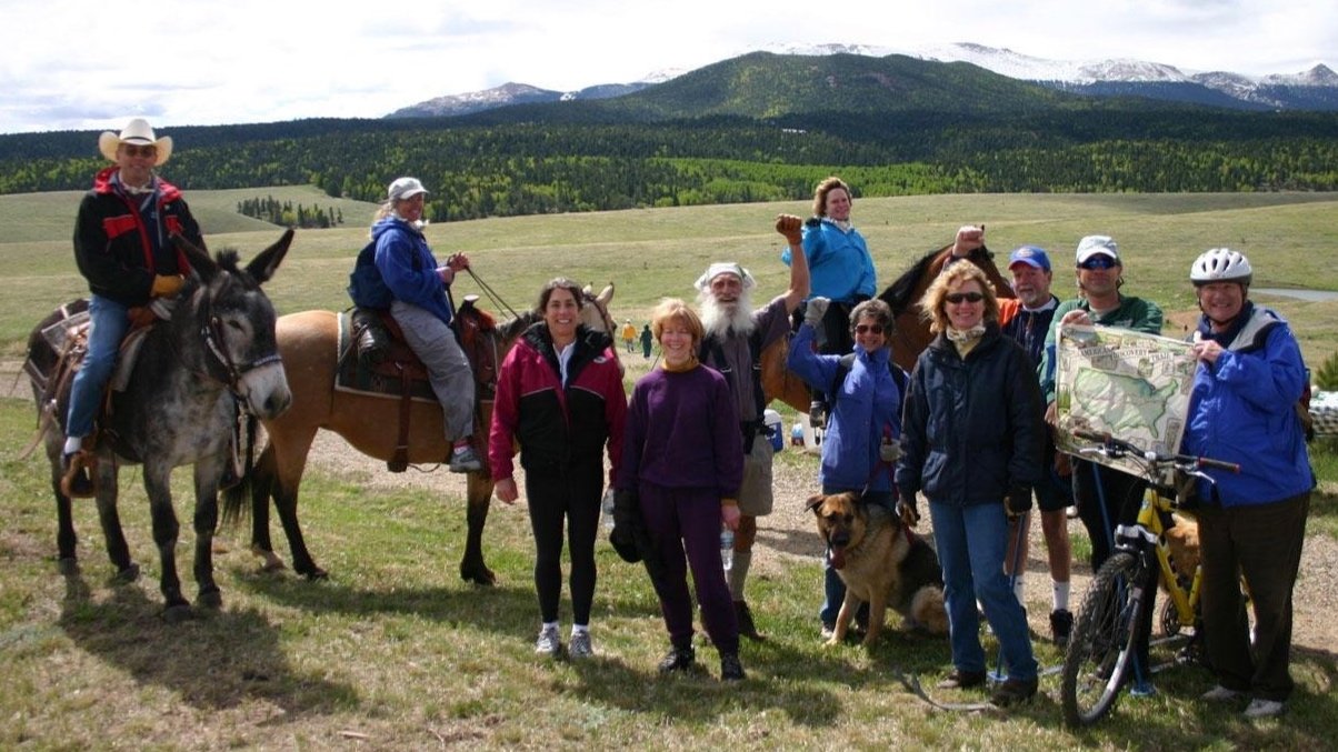
Who uses the American Discovery Trail?
While this might be a surprise, long-distance trails are actually mostly used by people who live near the trail, be it a morning run, walking the dog, enjoying nature or weekend outings. Backpacking excursions are variable in length, and some people are section hikers: every year they hike a portion fo the trail for several weeks, and after a period to years they have completed the entire trail. Of the estimated four million users of the Appalachian Trail each year, only about 1,200 walk the entire trail. It is similar for us, but we have bikers as well as walkers, and because of our trail’s proximity to urban communities, trail use in those areas is quite high.
Are there guidebooks and maps? Where can I get them?
Yes, and no. During its first 35 years multiple guidebooks were published and many people have posted suggestions on a wide array of websites with information about the trail, some focusing on the trail in particular towns or locals, and others addressing the entire trail.
The American Discovery Trail Society offers detailed turn by turn (TBT) instructions for the entire trail as well as GPX files for use with Google Maps, GPS devices, or cell phones. There are no (current) printed guidebooks with details about nearby facilities. Physical maps can be easily made one from the GPX files. TBT and GPX documents can be purchased from the ADT store and will be available through some online services in the near future.
When will I be able to walk or ride the entire trail?
You can do it now! If you have four to twelve months (or more) of free time, a person can go the whole distance. Biking is obviously faster than walking. The coast-to-coast distance using the northern route (through Chicago) is about 4,844 miles. The distance using the southern route (through St. Louis) is a bit longer, around 5,008 miles. The simple math: if a person travels 15 miles a day and takes one rest day a week, it would be 400 days (or nearly 60 weeks) to cover about 5,000 miles. A biker might average 60 miles a day, so that cuts it to 15 weeks.
What is the National Trails System?
The National Trails System Act (NTSA) was enacted by federal legislation in 1968 as a framework for a national system of connected scenic, historic and recreational trails. Today, there are 11 National Scenic Trails, which are protected scenic corridors for outdoor recreation located primarily in the backcountry; 19 National Historic Trails, which recognize prominent routes of exploration, migration, commerce, and military actions; and almost 1,300 National Recreational Trails, shorter trails which vary in length, terrain, difficulty and accessibility and are managed by public and private agencies at the local, state and national levels.
How does the American Discovery Trail fit into the National Trails System?
The American Discovery Trail has been proposed as the first of a new category of long-distance trails – National Discovery Trails – that will give recognition to the significance of urban and metropolitan trails that have developed mostly over the past 25 years, and to backcountry trails. This new category would recognize that using and enjoying trails close to home is equally as important as traversing remote wilderness trails. Recent developments include approved legislation in 2019 authorizing ADT signage on federal lands and a proposed legislation in 2022 for the formal classification.
Who do I contact to volunteer or join?
Contact the Society’s national office or any of our State Coordinators. You can also sign up for membership through the ADT Store.